Filling a gap in North London's road network, and potentially relieving two of London's existing major roads, this elusive motorway proposal never got beyond the ideas stage.
The GLC's Primary Road Network, a masterplan for a network of urban motorways through and around the city, was based on an almost scientific theory about what was required. It came with the concept of "optimum route spacing": roads would be placed at specific intervals, and radial routes would be evenly spread, as regular and neat as the numbers on a clock face.
In Inner London, between Ringway 1 and 2, the "optimum spacing" for radial routes was 4.5 miles (7 km). And around the clock face of London, that was achievable (given a certain amount of leeway) using existing major road corridors.
There were two exceptions. In South London, the gap between the M23 and A20 was too large, but thankfully a road first suggested by Abercrombie in the 1940s called Parkway E was already in the planning system. In inner North London, there were no major radial routes between the M1 and M11, an unforgivable gap of more like nine miles.
In the early 1960s, long before the hard realities of urban road construction in London had been understood, the fix was easy: add another radial route to fill the gap. So the GLC's planners did just that. In a sketch plan of route options in North and East London, produced around 1963 or 1964, one was inserted just where you'd expect to find it, half way between the M1 and M11.

The plan labels it the Possible North London Radial, but you can call it PNLR for short.
That sketch plan was one of a pair, showing the GLC's preferences for north London. Its counterpart, without the PNLR, showed the Ministry's. They were created at the time that Whitehall was proposing to scrap the M11's route up the Lea Valley and construct it in the Roding Valley instead.
The Ministry, of course, got their way, and the GLC's proposals were not adopted - but the PNLR seems to have stayed around a bit longer, as though the GLC's planners thought it might be an idea whose time hadn't yet come.
Outline itinerary
![]() Potential continuation to reach A1 or A1(M)
Potential continuation to reach A1 or A1(M)
![]() A1081 St Albans Road
A1081 St Albans Road
![]() A1000 Hadley Green
A1000 Hadley Green
![]() A110 East Barnet Road
A110 East Barnet Road
![]() Spur to A111 Cockfosters Road
Spur to A111 Cockfosters Road
![]() Ringway 2 North Circular Road
Ringway 2 North Circular Road
![]() A504 Turnpike Lane
A504 Turnpike Lane
![]() A503 Seven Sisters Road
A503 Seven Sisters Road
![]() Ringway 1 North Cross Route
Ringway 1 North Cross Route
![]() Potential continuation to A501 Euston Road at King's Cross
Potential continuation to A501 Euston Road at King's Cross
Route map
Scroll this map to see the whole route
Scroll this map vertically to see the whole route

Key to map symbols
| "Primary Road" Network | |
|---|---|
| Primary Road | |
| Primary Road section in tunnel | |
| Primary Road approximate or assumed line | |
| Primary Road cancelled or deleted before start of GLDP Inquiry | |
| "Secondary Road" Network | |
| Secondary Road single carriageway or of unknown formation | |
| Secondary Road known to be dual carriageway | |
| Secondary Road section in tunnel | |
| Junctions | |
| Location of Primary Road junction where layout is not known | |
| Location of Secondary Road junction where layout is not known | |
| Location of a junction cancelled or deleted before start of GLDP Inquiry where layout is not known | |
Route description
This description begins at the southern end of the route and travels north.
King's Cross to Barnet
The PNLR appears to be a combination of two proposals, which could either have been built independently of each other or could have been built together to form a single route. This description covers the whole length of the PNLR, encompassing both.
Commencing beside the eastern wall of King's Cross Station, at the end of the A5200 York Way, the PNLR would depart northwards from the one way system and join the east side of the East Coast Main Line railway tracks. It would follow the east side of this railway line for almost its entire route.
A short distance to the north, on the site where the HS1 Channel Tunnel Rail Link now enters its tunnel under north London, the PNLR would meet the Ringway 1 North Cross Route. A free-flowing four-way interchange would be constructed, with sliproads woven through the buildings and tracks of the surrounding railway lands.

The East Coast Main Line enters a tunnel here, and it's not clear whether the motorway would do the same, but a cut-and-cover tunnel would clearly allow the road to fit into the urban fabric better where the railway runs below ground level. The route then passes through the site of the modern Emirates Stadium, built many years after the road proposal was abandoned, before reaching an interchange with the A503 Seven Sisters Road next to Finsbury Park station.
Continuing north, the motorway would claim the western edge of Finsbury Park itself and take out the whole of the B138 Wightman Road, reaching another interchange at the A504 Turnpike Lane. Existing roads would be improved from this junction to provide a link to the A10. Staying alongside the railway through Wood Green, the next interchange would be with the Ringway 2 North Circular Road at New Southgate.
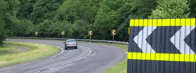
From this point land alongside the railway is less built-up, even today, and the potential for a motorway to use this corridor must have been obvious in the 1960s. A long run without junctions would reach the A110 Station Road at New Barnet, where a short spur would connect to the A111 at Cockfosters, and the motorway would then curve north-west towards Barnet itself, leaving the East Coast Main Line to pass through Hadley Wood.

A final junction would be provided at the A1000 Hadley Green before the motorway would terminate on the A1081 St Albans Road at the southern end of Old Fold Manor Golf Course. The northern end of the PNLR, at this point, is only a couple of miles from the A1(M) and Ringway 3 at South Mimms.
The way to King's Cross
While the PNLR never turns up in any formal, published plans of the GLC's Primary Road Network, and doesn't appear in the Greater London Development Plan, there's evidence it was still being contemplated through the 1960s.
One place it turns up is in a document from February 1967, created by the GLC's Department of Highways and Transportation, titled "North Central London Tentative Major Road Network". It shows all the things you'd expect: the Ringway 1 North Cross Route, the Eastern Avenue Extension, the Camden Town Bypass.
It also includes a short line from the North Cross Route down to King's Cross Station, labelled only as "possible link under investigation".

The phrase "under investigation" might have been a show of caution. Only a few months earlier, in summer 1966, consultants Travers Morgan had delivered the North Cross Route Engineering Report, containing plan and elevation drawings for the whole motorway. They included the outline of an interchange at Caledonian Road. To the south was marked a "future motorway link to King's Cross" - implying it was not so much "under investigation" as "under starter's orders".
The King's Cross spur makes some sense. At that point, the North Cross Route is closer to Central London than any other part of Ringway 1, and a stub of road 880 metres (half a mile) in length would open up all sorts of opportunities for traffic to hop on to the Ringway instead of travelling east-west on the A501 Euston Road.
The only oddity is that it's less than a mile east of the Camden Town Bypass, another road connected to Ringway 1 that would do exactly the same thing. Perhaps that's why a question mark still hung over it.
Space for the future
On the same Travers Morgan plan sheet, the road striking out northwards from the same interchange is labelled "Possible North London Radial Route" - there's that name PNLR again. Where it would go from there isn't indicated in the North Cross Route plans, but it's safe to assume that the intention was, as seen elsewhere, to continue it up the ECML all the way to open countryside at Barnet.

We don't have any indication of the thinking behind the PNLR proposal, but there are three educated guesses that can be made about the GLC's thinking, and none of them are a great leap of faith.
The first is that this part of North London is, in the GLC's highway plan, missing a radial route. The policy was for radials to be evenly spaced around London, but between the M1 and M11 there was a gap twice the usual width. Slotting a radial route into the gap, to even out the network, is the exactly the sort of thing you'd expect the GLC's planners to do. They did it in south London, too, with Parkway E, where the gap between the M23 and A20 was judged too big.
The second is that the A1 and A1(M) would have no continuation in towards Central London. The official plan was that the A1 would flow into the M1 at junction 3 via the Scratchwood Link, and the M1 would therefore serve traffic heading in and out of London for both the M1 and A1. But at some future date, the M1 might not be able to cope with that level of demand.
Its load could be eased by giving the A1 a separate route in to London. The PNLR reaches all the way from Central London to the Greater London boundary at Barnet, where it stops dead, but - we might speculate - only because the GLC couldn't plan a road in another county. Its end point is a ridiculous place to terminate a motorway, but it's only about two miles from the A1 at South Mimms, and it doesn't seem outrageous to wonder whether the intention was that it would actually continue to the A1.

The third is that the A10 would also have no continuation to Central London, the former London County Council's idea for a Cambridge Radial motorway having proven impractical and the GLC having found no way to improve the A10 itself. It would, in the official plan, stop at Ringway 2. But the sketch plan of the PNLR specifically marks an "improved link" between its junction with the A504 Turnpike Lane and the A10 at The Roundway. The implication is that A10 traffic could make a short hop over to the PNLR for journeys in to London.
The conclusion, then - a speculative one, of course, because there is very little evidence to go on - is that the PNLR might have been considered as an idea for the distant future, to provide additional relief to the M1, A1 and A10 routes in to London when they became overloaded, and to complete the pattern of radial routes around the capital.
It's interesting to think that the GLC's plans suggested that some of the later parts of the road network, including the South Cross Route and Parkway E, might only be built post-1991. If the PNLR wasn't ready for inclusion in a plan that reached that far ahead, it couldn't have been due for construction before the 2000s. It was, in other words, an idea so far distant in time from its planners that it is, perhaps, no wonder that it was barely planned at all.
Picture credits
- Route map contains OS data © Crown copyright and database rights (2017) used under the terms of the Open Government Licence.
- Sketch map of major roads in North London and network plan with gap between M1 and M11 are extracted from GLC/TD/PM/CDO/07.
- Ringway 1/PNLR interchange diagram is extracted from MT 106/437.
- Photograph of ECML at Hadley Wood is taken from an original by Christine Matthews and used under this Creative Commons licence.
- 1967 GLC plan with link to Kings Cross is extracted from MT 106/195.
- Photograph of York Way in 1989 is taken from an original by Ben Brooksbank and used under this Creative Commons licence.
Sources
- PRN "optimum route spacing" theory; Parkway E inserted specifically to even out gap in radials: HLG 159/1024.
- Route, King's Cross-R1; "Tentative Major Road Network" plan: MT 106/195.
- Route, R1-Barnet; sketch plan for GLC and MOT route options showing PNLR: GLC/TD/PM/CDO/07/327.
- North Cross Route Engineering Report: MT 106/437.
- Details of A1 and A10 are on their respective pages.